The first that a user must decide, is what an intervall he want to use.
I believe for normal fishing application 1 m or max 0,5 m difference is sufficient
I see two ways in principle:
Way 1- The present chart will used, only the depth lines will be adapted.
It's the much simpler way, but not optimal for the flooding, shoreline area. - Each depth level requires a separate chart. The charts contain different
area- and line combination. This way is much heavier and also the datas
for the shallow areas are not simple to collect.
For the use of such charts in the unit there is also 2 options:
- Each chart is a separate AT5 file. In this case max 2 SD-cards required.
One card contain all different AT5's. With help of the internal memory of
the HDS You can copy files in a second SD-card again and again. - All datas (different depth charts) are located in a single AT5 file.
Way 2This way requires explanations.
It's a new property of the
IMC, which the user can use in the the next release v0.7.4,
for HDS units only I think. With this function it will be possible to give the chart categories
own names, whatever You want. In this case, You can name each depth chart with a
separate MIN_CAT. Now, the chart categories You can switch on/of on the unit, if You want
Here is a sample,
which show the principle (e. g. with - 1 … - 7 m, 0 m , + 1 … + 20 m offset in meter steps)
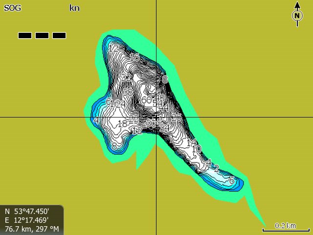
Here you can see my fictive sample lake in overview.
The inaccurate shoreline area for higher water levels are yellow-green in color.
Here you see the elemental chart with "0 m".

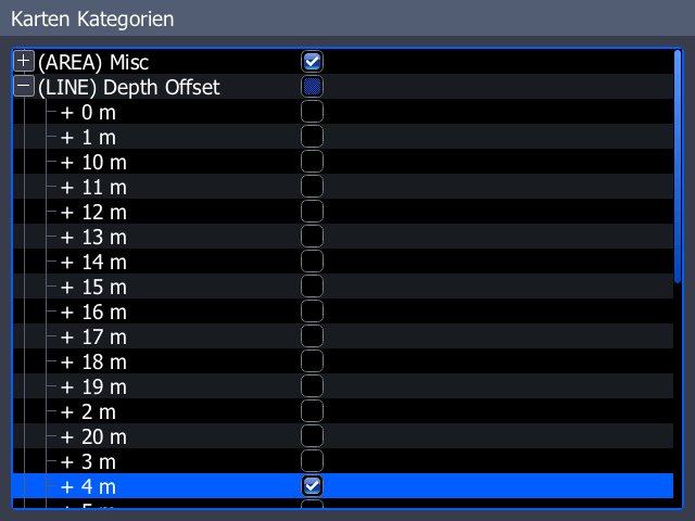
here you can see the open chart categories. I have switch off all charts unless the new "+ 4 m" chart.
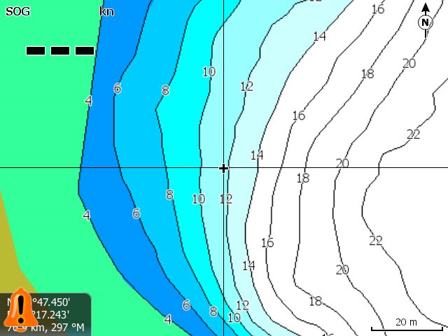
This show the result: "+ 4 m", (minus values also in other charts)
Note: If the new IMC appears, i will add explanations.
You must also apply a trick with the unit, otherwise the unit will be freeze.

 Thema: charts for waters with fast variable depth level (barrages) (Gelesen 6020 mal)


